Christmas 2006
Kristina, Susie, and I did a lot of traveling over Christmas break.
We managed to leave on time despite having to install a computer
cluster last-minute immediately before we left. We went to
Maryland and Pennsylvania for my Grandmother's annual Christmas get-together.
Then we went to Cape Cod for Christmas.
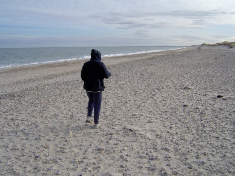
The weather has been extremely mild all up and down the East coast, but we
had to bundle up a little bit when going to the beach:
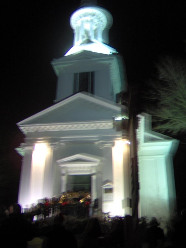
We went to a Christmas Carroll sing in front of the
First Church in
Sandwich. My camera doesn't do well with the dark:
We actually found a waterfall on the very-flat Cape! Well, it's an
extremely old mill run in East Sandwich, next to the
Benjamin Nye Homestead:
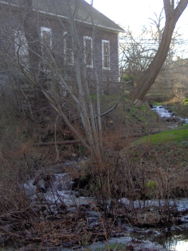
Kristina took that picture when she went back later on Christmas Eve.
I was stuck in bed sick all day. For some reason the only
time I get sick all year is when I visit Massachusetts for the holidays.
The big gift we got at Christmas was a GPS unit. So now I can bore
you with both pictures and gratuitous latitude/longitude readings.
After Christmas we went back down to Maryland. It took forever to get there;
something must be done about New Jersey.
While in Maryland we got to visit various family members and friends living in
the Baltimore/Washington area. We got to see my brother's new place in
Rockville and played a lot of board games before he had to go to work
(he had to work weekends over the holidays due to the financial year ending).
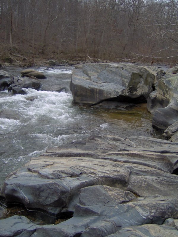
On New Year's eve we went for a hike in
Gunpowder Falls State Park.
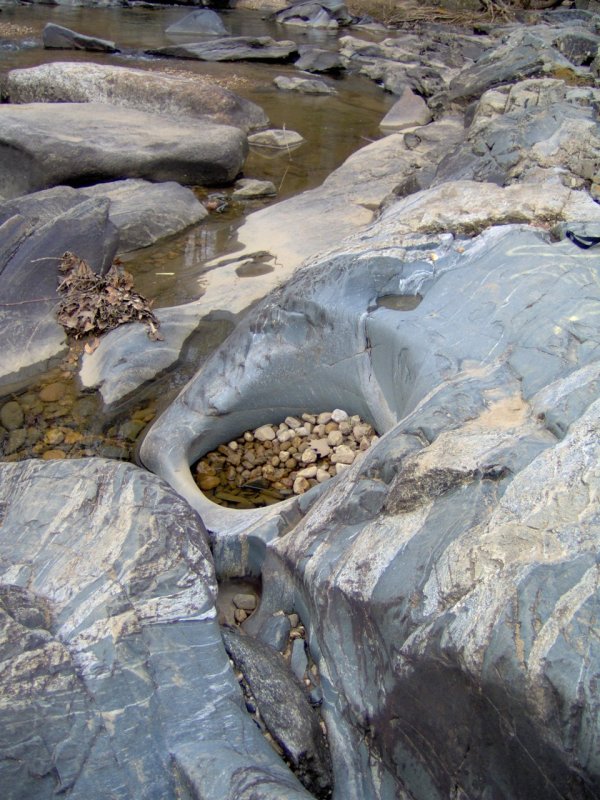
Here is a view of the river near an area called the Potholes:
And here is a close up of one of the potholes
(at 39°N 25' 4.6200", 76°W 25' 38.9604"):
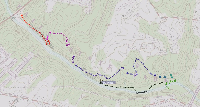
And here, thanks to our GPS, is our rough path. The pothole area where
the above picture was taken is marked (we only had one set of nearly-dead
batteries so there was a lot of awkward swapping between the camera and GPS).
Parts of the track are missing
because it is hard to get enough satellites for a fix in the steep valley.
Also note the GPS unit only has around 30 foot accuracy in the best of times,
which explains why on the map it looks like we were wading across the river
(I can assure you we didn't):
After New Years we returned to unseasonably warm Ithaca. It took 2 weeks of
being back before the temperature even went below freezing! (We got
an indoor/outdoor thermometer for Christmas too).
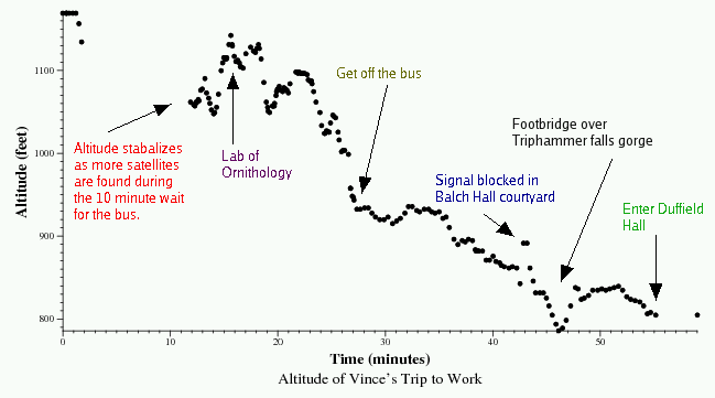
Some last GPS fun. Here is a plot of the altitude change on
my average trip to work:
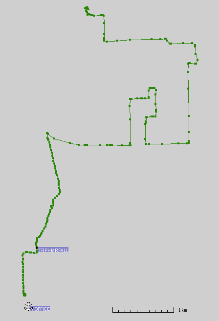
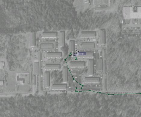
My actual path to work is a bit convoluted. Here it is plotted below.
The winding path at first is because my bus takes a convoluted path in
(luckily it is more direct coming home). Where the points suddenly get
closer together it shows where I am walking. I tend to get off the bus
early to get some exercise. Triphammer Falls is marked, it's the one you
see here
(though it isn't that icy yet this year):
The Linux GPS program I use (
Viking GPS) can call up some very disturbingly detailed
pictures to go along with the GPS data. Here it shows in detail me
cutting across the parking lot to get to the bus stop. (ignore the anchors,
the program gets a bit mixed up about waypoint icons):
Anyway, that is all for now. Only a few more weeks until the
semester starts and things get really busy again.
Back to main pictures page